top of page

Types of Maps
Scatterwoods Mapping is different because we like to provide multiple perspectives of the same property on the same poster. Options for maps can be seen below. Most of our maps are a combination of all four.
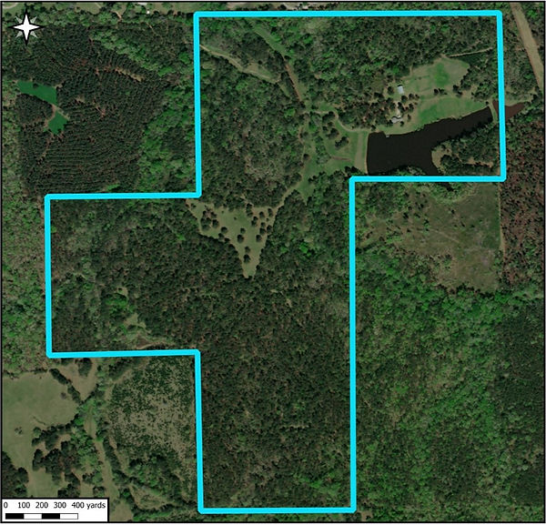
Satellite Image Map
-
Standard map – nothing new
-
We can add labels, road outlines, fence lines, etc.
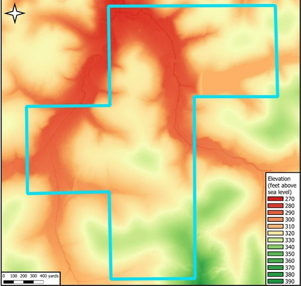
Elevation Heat Map
-
A unique way of evaluating elevation
-
Easily identify topographical features such as saddles, ridges, and creek bottoms
Slope Degree Map
-
A way of comparing the flat and steep parts of a property
-
A different perspective on topographical features

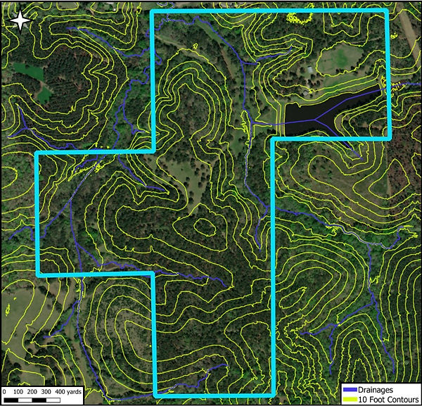
Contour Elevation and Drainage Map
-
Combination map that highlights how topography determines the flow of water on a property
bottom of page